Traffic Accident Scene Intelligent Positioning Software
- Category:Smart Security
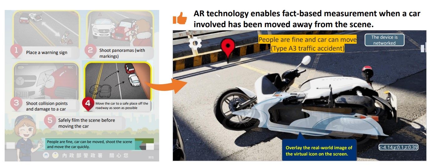
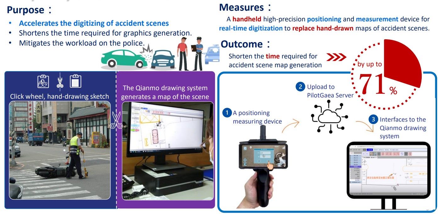
Status:Complete The Project is a collaboration between Taipei City Police Department and PilotGaea Technologies Co., Ltd. The solution provides a software/hardware integrated high-precision positioning and measuring portable device that replaces distance measuring wheel and hand drawing to speed up the digitalization of accident scene drawing, thereby shortening the time to produce the ultimate scene drawing. The implementation process for users is described below: (1) Users use plug-in APP software installed in the portable device and smart phone at the scene. (2) Click evidence: Set up at least two points of reference and click the evidence on the real-time screen to make the marking. Incorporate shooting to add more details to the photo records of accidents at the scene. (3) Click on the scope of evidence: Provide users with the scope of evidence drawing for the record to facilitate the subsequent presentation as square icons on the system to indicate the scope of the accident vehicle. (4) The system implementation will calibrate the data collected with the reference point, and then overlap on the Qian-Mo System to undergo the digitalization process. Qian-Mo System will call the server to provide the positioning message, photos and video file of the case according to the case number. The reference points will be used to capture the position of the objects. After shifting the two base points, turning the vector position to integrate the measurement objects on the Qian-Mo map, and thereby saving the complex drawing procedures from scratch.

![Taiwan.gov.tw [ open a new window]](/images/egov.png)